In a previous blog post, we discussed some unique characteristics of winter air quality. Namely, how fine particulate readings are often higher overnight and early in the morning compared to the afternoon. On the night of January 21, 2024 we witnessed such an event, with elevated fine particulate values across the interior of the state and even reaching into the Code Red range for several hours in Cumberland County. Let’s discuss the meteorology behind why this occurred and how we handle communicating episodes like this to the public.
All the Ingredients for Pollution Buildup
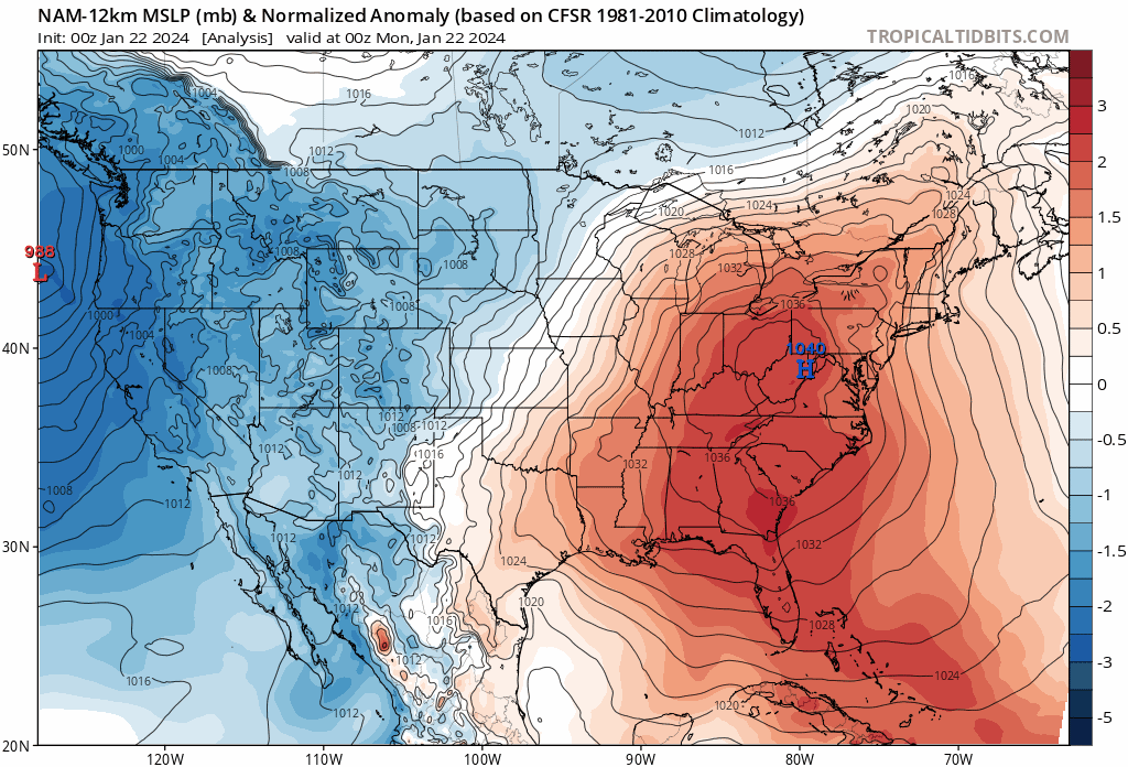
An area of strong Arctic high pressure that had been nosing in for a few days drifted directly overhead on the evening of Jan 21. High pressure is characterized by sinking air, light winds, and air mass stagnation. At this same time, a mid-level ridge (i.e., high pressure) was also building over the eastern U.S. which acted to reinforce these air mass characteristics. Once the sun set on Jan 21, temperatures dropped into the teens under clear skies and winds were calm throughout most of the state.
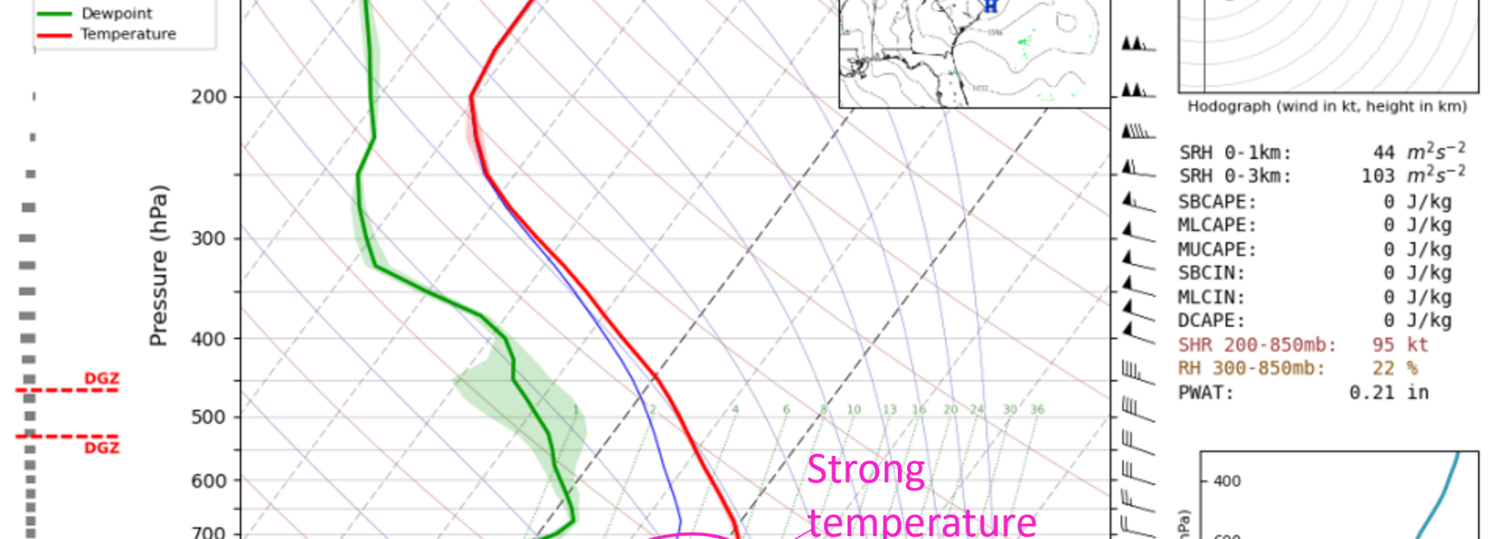
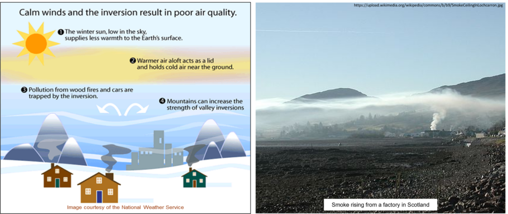
These factors contributed to the development of an unusually strong overnight temperature inversion. In a typical near-surface temperature profile, the air is warmest near the surface (thanks to the heat absorbed and re-emitted by the earth) and gets cooler with height. In the winter, however, it’s common for the inverse to happen. Temperatures near the surface can get colder than those above, and the elevated warm layer traps the denser, colder air near the surface. This effectively creates a lid or cap which also traps pollution.
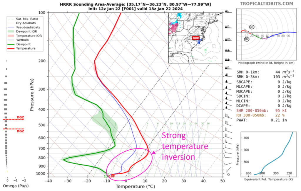
The x-factor in why this pollution episode was particularly notable is an uptick in residential wood burning that night as folks battled the extremely cold temperatures. Smoke from these fires would have been trapped within the inversion layer and likely contributed to localized poor air quality. Imagine the below image at night:
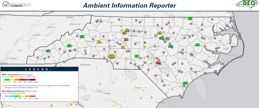
The impact of the smoke within the inversion is evident in our observations beginning at about 8pm on Jan 21, as more and more areas of Code Yellow fine particulate levels were measured. Fast forward to 2am on Jan 22 and you have a Code Orange and Code Red hourly measurement! You can see multiple small fires and smoke plumes below in the AIR tool analysis. You can also see how calm the winds were at that time, contributing to the stagnation.
Communicating the Forecast Adjustment and a Word on Air Quality Data
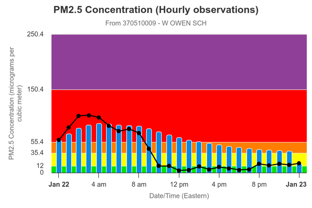
We anticipated that the inversion would break the next morning amidst increasing winds and atmospheric mixing, effectively dispersing the built-up pollution. You can see this happening in the plot below between 8-10am, which shows the hourly PM2.5 measurements at our Cumberland County monitor on Jan 22. Because NC DAQ forecasts a 24-hour average PM2.5 concentration (per the EPA short-term primary standard), we knew that Code Red conditions would not be a threat beyond the morning hours and would net out closer to the Code Yellow range.
NC DAQ adjusted the daily forecast in the morning and explained these nuances in the morning forecast discussion, which was also posted on our social media. However, we know that many people saw emails or phone alerts about poor air quality during this episode. If you were in Cumberland County, for example, you may have been alarmed to see that Code Red PM2.5 values were present but also wondering why NC DAQ had not issued an official alert. Our next multi-part blog series will explain various air quality data platforms and why the information you’re viewing may differ, especially during short-lived events such as this. Stay tuned!