March heralds the start of not only meteorological spring – even if it may be colder than February was! – but also the official start of the 2023 ozone season in North Carolina. From March 1st through October 31st, DAQ forecasters add the ozone AQI to our daily county-level forecasts. But why do we only forecast for ozone during these months, while we forecast for particulate matter year-round? The answer comes down to both chemistry and meteorology.
Ozone Season Excludes Winter
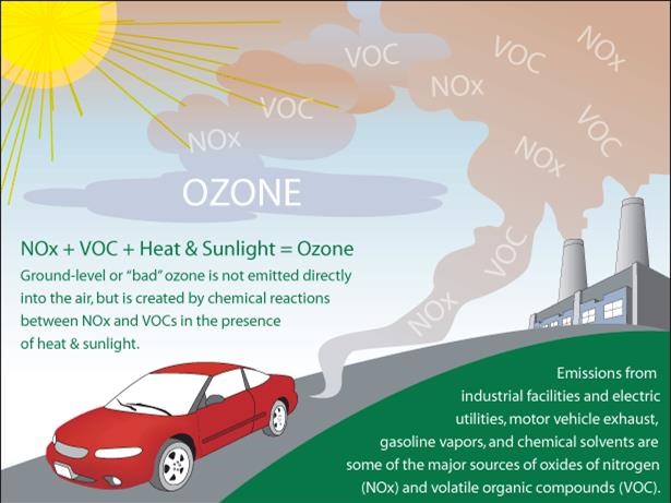
Ground-level, or tropospheric, ozone is not typically emitted directly by any single source but rather is a product of photochemical reactions. It is formed through a reaction between certain pollutants emitted at ground-level (nitrogen oxides and volatile organic compounds) and sunlight.

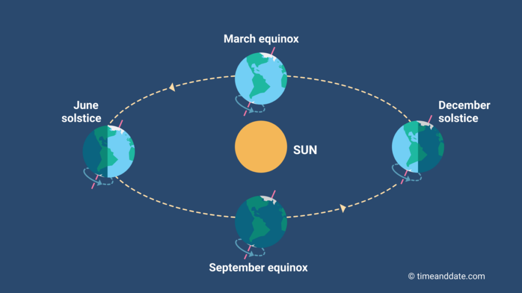
During winter, the Northern Hemisphere is tilted away from the sun and receives the least amount of direct solar radiation (sunlight), thus one of the essential ingredients for ozone formation is missing and as a result, ozone formation is significantly lower.

Some states and regions have slightly different ozone seasons, depending upon that area’s particular climatology and historical observations. Unhealthy ozone levels are generally not common in the winter months in NC, when the angle of the sun is lower and the days are shorter. Therefore, the need for daily ozone forecasting drops off during the winter.
Curious Case of Overnight Mountain Ozone
So remember everything we just discussed about ground-level ozone needing sunlight to form? While this is certainly true, there is a seemingly strange exception to this rule that occurs every year at high elevation monitors (not just in North Carolina).

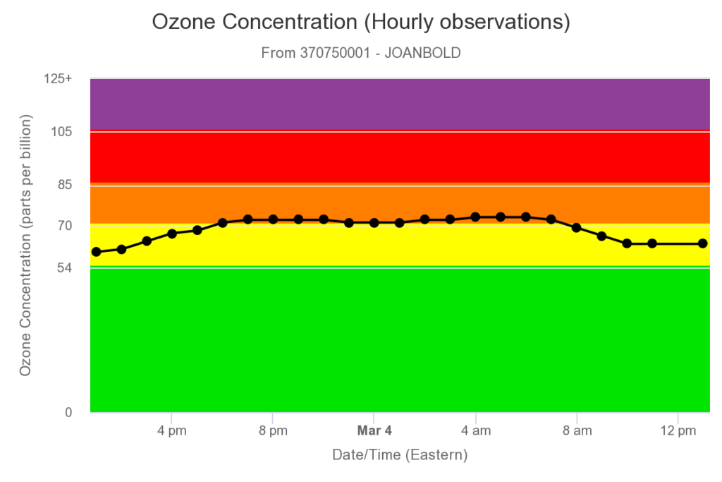
Almost every year, especially during the spring, one or more of our high elevation monitors will record a period of elevated ozone concentrations that begins during the overnight hours and slowly decreases the next morning, when sunlight is increasing!
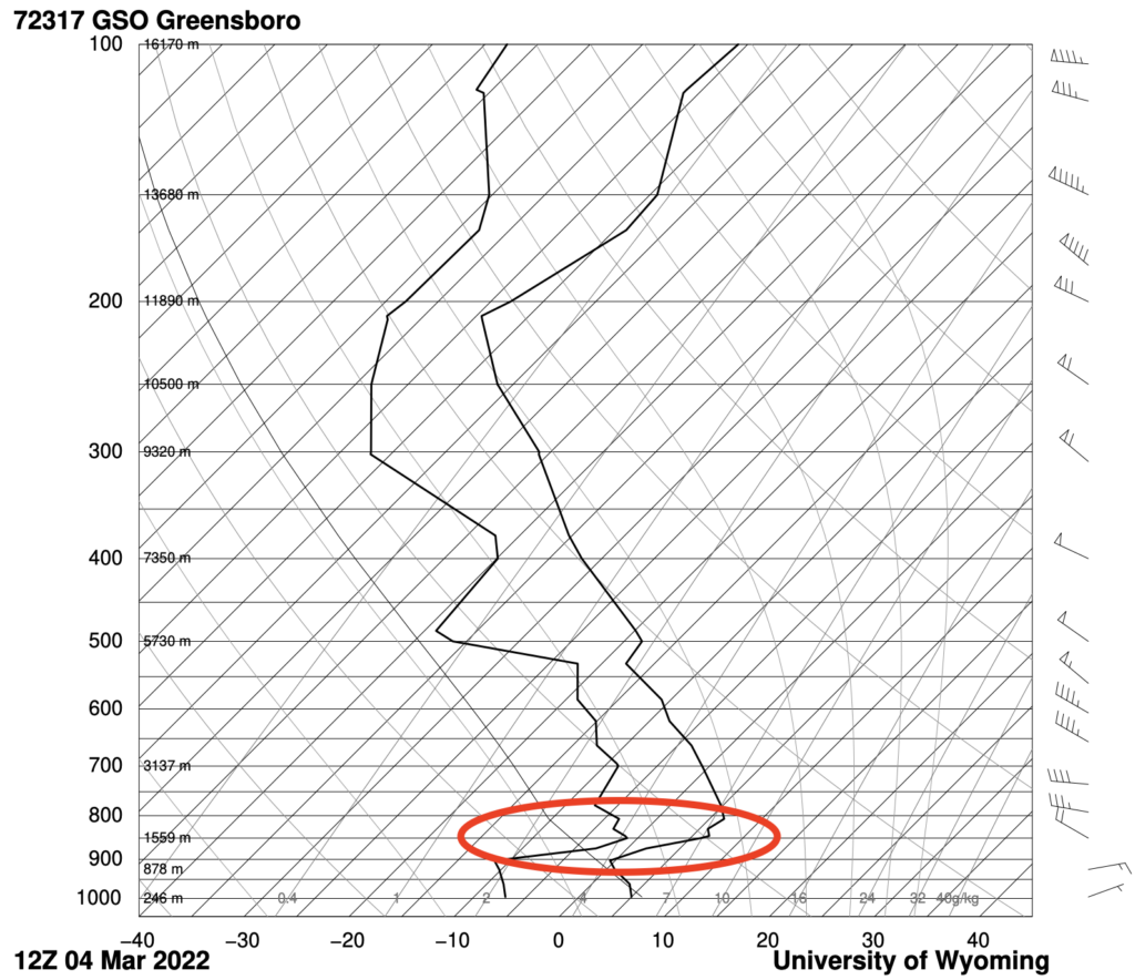
What is the cause of this odd occurrence? The answer is: temperature inversions. However, unlike our previous post discussing winter-time surface temperature inversions, this time the temperature inversion is occurring at a higher altitude, near the level of our mountain ridges.

The effect is the same, however. Warmer air (encircled area in the above image), above a colder level (this time near the ground), traps ozone in a layer near the ridge tops. This results in a barrier (think of rising air hitting a lid), where ozone can’t rise any higher, thus allowing it to pile up and concentrations to rise until the next morning, when sunlight warms the entire air column and the inversion diminishes.
As we’ve discussed before, significant reductions in ozone pollution in North Carolina have been observed over the past decade in response to more stringent regulations, but days with elevated ozone levels do still occur when conditions are favorable. Prolonged periods of hot, sunny weather and light winds (often under areas of high pressure) allow air masses to stagnate. Continue to follow our daily forecasts to ensure you have the information you need to stay healthy!
 Air Quality Portal